![]()
![]()
![]() SAR Technology -
Software & Services
SAR Technology -
Software & Services 
- What's New -
 What's
New in 'Incident Commander Pro'
What's
New in 'Incident Commander Pro'
October 2019
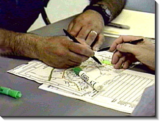
 Pattern
Commander – Pattern Commander permits a wide range of search patterns to be created and
plotted. These include Parallel Track, Baseline Grid-Search, Expanding Square,
Creeping Line Ahead, Sector Search and Point-To-Point search patterns. These
patterns are created as both KML and GPX files. These detailed search patterns can be
displayed in both ‘Incident Commander Pro’s GIS map display and in Google
Earth.
Pattern
Commander – Pattern Commander permits a wide range of search patterns to be created and
plotted. These include Parallel Track, Baseline Grid-Search, Expanding Square,
Creeping Line Ahead, Sector Search and Point-To-Point search patterns. These
patterns are created as both KML and GPX files. These detailed search patterns can be
displayed in both ‘Incident Commander Pro’s GIS map display and in Google
Earth.
 Image
Commander – Image Commander enables the users images to be displayed as ‘Post-It style
overlays on ‘Incident Commander Pro’s GIS map display. Any image can be
placed at any size and location on the map display. These ‘Post-It’
style images can also be labelled with map coordinates or any other text
description relating to the image. This can be useful for displaying evidence,
clues, landmarks, local features or any other type of imagery that adds local detail
to the map display.
Image
Commander – Image Commander enables the users images to be displayed as ‘Post-It style
overlays on ‘Incident Commander Pro’s GIS map display. Any image can be
placed at any size and location on the map display. These ‘Post-It’
style images can also be labelled with map coordinates or any other text
description relating to the image. This can be useful for displaying evidence,
clues, landmarks, local features or any other type of imagery that adds local detail
to the map display.
January
2017
 Point
Of Interest Commander – POI Commander takes all of the user’s Points
of Interest, (Name, Description and Location) and selectively displays in Google Earth only
those located within a specific user-defined region. This can be
useful for both displaying and reporting only the POI’s found within a defined
region within a much larger geographic area, e.g. airports along a flight path,
fire-halls near a wildfire, cell-phone towers within a search area, etc.
Point
Of Interest Commander – POI Commander takes all of the user’s Points
of Interest, (Name, Description and Location) and selectively displays in Google Earth only
those located within a specific user-defined region. This can be
useful for both displaying and reporting only the POI’s found within a defined
region within a much larger geographic area, e.g. airports along a flight path,
fire-halls near a wildfire, cell-phone towers within a search area, etc.
September
2016
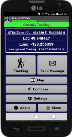
![]() SAR Technology
is pleased to announce... 'Track
Commander V2'
SAR Technology
is pleased to announce... 'Track
Commander V2'
- Smart-phone Tracking, Messaging & Navigation for Responders.
- Cost-effective tracking and messaging for responders.
- Designed for tough, real-world duty.
![]()
![]()
![]() -
Tracking, Messaging & Navigation.
-
Tracking, Messaging & Navigation.
![]() -
'Dual-Track' GPS Tracking - for Speed and Accuracy.
-
'Dual-Track' GPS Tracking - for Speed and Accuracy.
![]() -
Automated Tracking at User-Defined Intervals.
-
Automated Tracking at User-Defined Intervals.
![]() -
Power Saving Design for Extended Duration.
-
Power Saving Design for Extended Duration.
![]() -
Ten Pre-Defined Messages.
-
Ten Pre-Defined Messages.
![]() -
Ten Custom Messages.
-
Ten Custom Messages.
![]() -
SOS & Help
Messages - to your Response Team.
-
SOS & Help
Messages - to your Response Team.
![]() - Automatic Out-of-Range Alerts.
- Automatic Out-of-Range Alerts.
![]() - Plots Tracks &
Messages on 'Incident Commander Pro'.
- Plots Tracks &
Messages on 'Incident Commander Pro'.
![]() - Plots Tracks &
Messages on 'Global Earth Tools' - Google Earth.
- Plots Tracks &
Messages on 'Global Earth Tools' - Google Earth.
![]() - Multi-User Team and Agency Features.
- Multi-User Team and Agency Features.
![]() - No Expensive Tracking Hardware.
- No Expensive Tracking Hardware.
![]() - No Expensive Tracking Fees.
- No Expensive Tracking Fees.
![]() Fully compatible with ‘Incident Commander Pro’
Fully compatible with ‘Incident Commander Pro’
and Global Earth Tools - for Google Earth.
![]() 'Track
Commander' - Professional Grade Tracking System
'Track
Commander' - Professional Grade Tracking System
![]() For Android Smart-Phones
For Android Smart-Phones
i - for use in regions with
cellular coverage
14th May 2014

![]() SAR Technology
is pleased to announce... Multi-Platform
Connectivity.
SAR Technology
is pleased to announce... Multi-Platform
Connectivity.
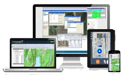
You may now run 'Incident
Commander Pro' remotely from your computer,
tablet or smart-phone!
![]()
![]()
![]()
![]()
![]()
Multi-Platform Connectivity, using Chrome
Browser RD,
supports a wide range of operating systems.
At work, at home,
the command post or on the road, you always have immediate access to 'Incident
Commander Pro'.
True mobility. Anywhere, for any mission.
15th
May 2013

![]() SAR Technology announces Global
Earth Tools for Google Earth
SAR Technology announces Global
Earth Tools for Google Earth
Global Earth
Tools Delivers
Planning,
![]() Tracking,
Tracking,
![]() Messaging and
Messaging and
![]() Tactical Displays to Google
Earth!
Tactical Displays to Google
Earth!
![]() - Combines the powerful
capabilities of 'Incident Commander Pro' with the enhanced visualization
of Google Earth!
- Combines the powerful
capabilities of 'Incident Commander Pro' with the enhanced visualization
of Google Earth!
![]() - Advanced features
rapidly generate real-time Tactical Displays in Google Earth.
- Advanced features
rapidly generate real-time Tactical Displays in Google Earth.
![]() - Powerful and easy to use - SAR
Technology's Global Earth Tools for Google Earth.
- Powerful and easy to use - SAR
Technology's Global Earth Tools for Google Earth.
6th
November 2012
![]()
![]() New
Beacon Symbols available for
Real-Time Tracking
New
Beacon Symbols available for
Real-Time Tracking
'Incident Commander
Pro' can display real-time tracking for a wide range of GPS-beacon
and GPS-radio tracking devices, including the DeLorme-InReach, GeoPro-Nano, GeoPro-Messenger, SPOT-Beacon, SPOT-Connect, Connected-GPS, GPS-Radios and
iPhone-Tracker.
A new collection of beacon map symbols
is now available for each of these types of
tracking devices. These symbols can be displayed in user-selected size, color
and symbol name. Being able to match the symbols appearance to the type of
tracking device makes it easier to identify each device on the map
display.
31st
October 2011
 'Incident Commander Pro'
- Faster, easier network access for all team members
'Incident Commander Pro'
- Faster, easier network access for all team members
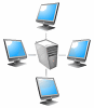
 Networking
'Incident Commander Pro', for multi-user access, has become faster
and easier with Windows 7. Combining Windows 7's built-in networking capability
with the network-friendly design of 'Incident Commander Pro',
makes it fast and easy to share mission information between all members of the
response team. Now mission and mapping data can be easily viewed by all
team members. Improved information sharing, plus the ability to view and print
information from any network location, permits all team members to actively
participate in the mission response. Detailed
instructions are now available for quickly setting up an 'Incident Commander
Pro' Windows 7 multi-user
network.
Networking
'Incident Commander Pro', for multi-user access, has become faster
and easier with Windows 7. Combining Windows 7's built-in networking capability
with the network-friendly design of 'Incident Commander Pro',
makes it fast and easy to share mission information between all members of the
response team. Now mission and mapping data can be easily viewed by all
team members. Improved information sharing, plus the ability to view and print
information from any network location, permits all team members to actively
participate in the mission response. Detailed
instructions are now available for quickly setting up an 'Incident Commander
Pro' Windows 7 multi-user
network.
22nd August 2011
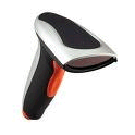
 |
Scan |
SAR Technology now offers fast, mobile access to it's SAR Resources, Software and Services - directly onto your smartphone.
![]() Use your smartphone to scan the barcode and instantly display SAR Technology's
extensive collection of SAR products and advanced technology services. Each SAR Technology
webpage now has it's own unique barcode, for
direct smartphone access to software, data and services for Land, Sea and Air
emergency-incidents.
Use your smartphone to scan the barcode and instantly display SAR Technology's
extensive collection of SAR products and advanced technology services. Each SAR Technology
webpage now has it's own unique barcode, for
direct smartphone access to software, data and services for Land, Sea and Air
emergency-incidents.
Viewing, storing and sharing this unique information is now fast, portable and hassle-free!
![]() Download the free Barcode
Reader
Download the free Barcode
Reader
8th June 2011
![]()
SAR
Technology is pleased to announce it's new Aircraft
'Crash Map' Service
for missing aircraft.
This advanced planning service is now enhanced with powerful 3D
Imagery, World-Wide Response Capability and fast turn-around.
Visualizing the search areas for missing aircraft is now fast, detailed and
highly intuitive.
Calculated Aircraft Crash Maps can
now be
rapidly delivered to organizations and individuals, virtually anywhere in the world.
With the unique
capability to create Crash Maps for both fixed-wing aircraft and helicopters this valuable service
may be used for the vast
majority of air-search incidents.
9th March
2011
 'Incident Commander Pro'
- For Marine Mission Response
'Incident Commander Pro'
- For Marine Mission Response
Marine
SAR incidents provide unique challenges for a rapid mission response. Time,
distance, weather, sea-state, currents, visibility and drift make delivering a successful response a highly complex and challenging
task. 'Incident
Commander Pro' provides the unique ability to integrate marine data, response areas and manage the mobilization of ships, aircraft,
equipment and personnel. In
addition to displaying a wide range of open-source maps, free
US NOAA
Electronic Navigational Charts and Raster Navigation Charts have also been converted
for display in 'Incident Commander Pro'.
29th
September 2010
'Incident Commander Pro'
- Fast Performance on Windows 7
'Incident Commander Pro' has shown excellent speed and performance using the
latest Windows 7 operating system.
Compared against a typical dual processor laptop running Windows XP Service Pack
2 'Incident Commander Pro', on a new laptop running Windows
7, showed significant performance improvements. For large image mapfiles,
displayed in the GIS mapping module, zoom and pan speeds were almost twice as
fast as the typical laptop running Windows XP. Improved screen resolution and
larger map-area displays also enhanced the appearance and performance of 'Incident Commander
Pro' - for a faster and more agile mission response.
21st March
2010
 SAR
Technology Inc. is pleased to offer additional new
products to enhance the mission response capability. These new products
include:
SAR
Technology Inc. is pleased to offer additional new
products to enhance the mission response capability. These new products
include:
![]() An extensive collection of detailed Map
Symbols.
An extensive collection of detailed Map
Symbols.
![]() Comprehensive
new planning Data
Sets.
Comprehensive
new planning Data
Sets.
![]() A powerful,
automated Barcode
Package.
A powerful,
automated Barcode
Package.
![]() High resolution Digital
Topographic Maps.
High resolution Digital
Topographic Maps.
For more information on these exciting new products please visit SAR Technology Sales.
31st October
2009
 SAR
Technology Inc. is pleased to offer it's new Real-Time Mission Response service.
SAR
Technology Inc. is pleased to offer it's new Real-Time Mission Response service.
With large areas to search and limited survival times it is critical that the
search be conducted in the fastest and most efficient way possible. Real-Time Mission Response
allows your team to focus on the numerous practical and logistic
challenges of the mission, while SAR Technology delivers to you a fast,
customized response plan.
Your basic mission search
information may be submitted as an email, text-file or spreadsheet
or - even faster - directly exported from 'Incident Commander Pro'. SAR Technology
will then deliver to you a unique,
customized response plan - specifically optimized for your mission. These
scientifically-designed Custom Search Plans will typically deliver faster and more effective
searches - with a higher probability of mission success.
16th
September 2009
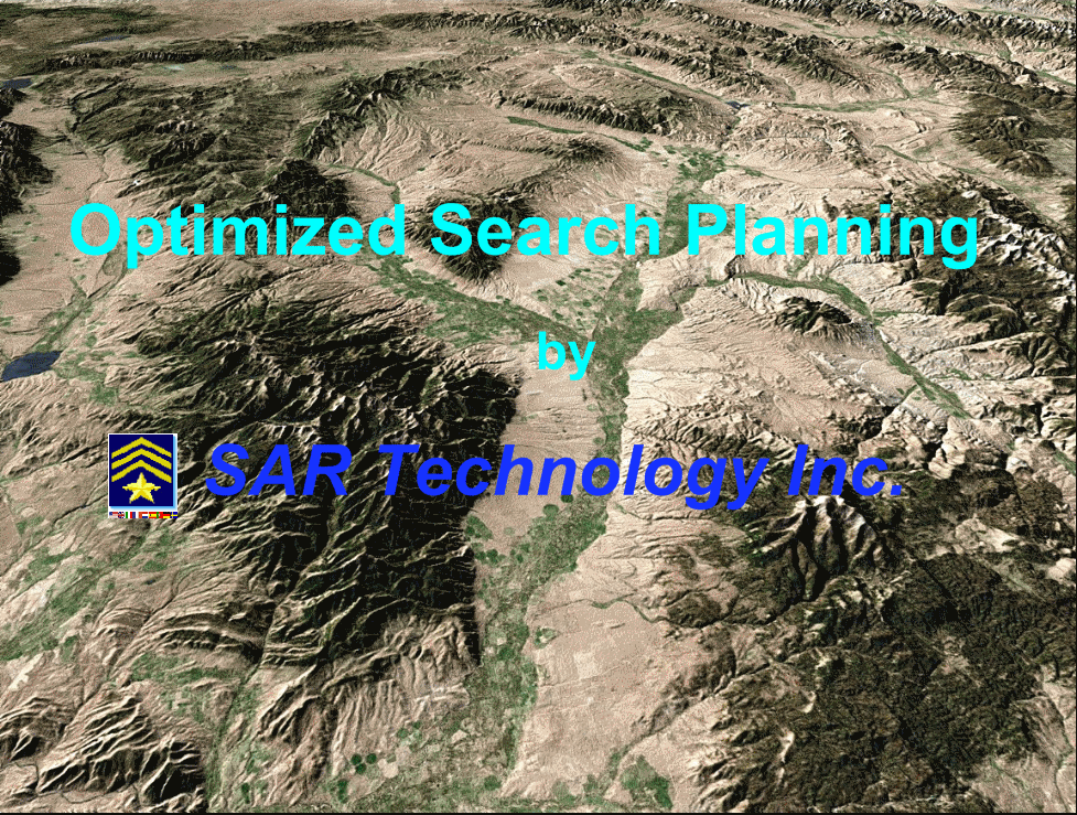
Optimized
Search Plans for 'Incident Commander Pro'
SAR Technology's unique Optimized
Search Plan creates search missions with the fastest mission
response and highest probability of success. Every assignment is precisely
calculated to send exactly the correct number of searchers, to the most
important areas, in the most efficient deployment sequence. This leads to a very
fast and highly efficient search, with every resource utilized to it's maximum
capacity.
'Incident Commander Pro' s
![]() Mission
Search Areas plan can now be
Mission
Search Areas plan can now be ![]() exported directly to SAR Technology Inc., where an Optimized Search
Plan can be rapidly generated and the results emailed back to the requesting
team. In this way the responding team has it's own unique and highly
efficient Optimized Search Plan, no matter how large or complex the search
incident.
exported directly to SAR Technology Inc., where an Optimized Search
Plan can be rapidly generated and the results emailed back to the requesting
team. In this way the responding team has it's own unique and highly
efficient Optimized Search Plan, no matter how large or complex the search
incident.
30th
July 2009
 'Train
the Trainer' course for 'Incident Commander Pro'
'Train
the Trainer' course for 'Incident Commander Pro'
With the expanded use of 'Incident Commander Pro' throughout North
America there has been an increased demand for qualified 'Incident Commander
Pro' trainers to provide local training courses. To meet this demand a new group
of qualified trainers have recently completed the intensive 5-day 'Incident
Commander Pro' 'Train the Trainer' course, required to qualify as a
certified 'Incident Commander Pro' instructor. SAR Technology Inc. is now
pleased to be able to provide this new cadre of qualified instructors to meet
local training demands within Canada and the US. For more information please
contact SAR Technology's Training
Program.
29th April 2009
 Barcode
Personnel Check-In with 'Incident Commander Pro'
Barcode
Personnel Check-In with 'Incident Commander Pro'
'Incident Commander Pro'
now features a rapid Barcode Check-In system, for the fast, error-free Check-In of available
personnel.
For the
Check-In
of existing team members, or for registering new personnel responding to an incident, the new
Barcode
Check-In system permits
personnel to be managed quickly and easily. The
'Incident
Commander Pro' system can now create Personnel ID cards and Personnel
Lists for team members, that can be rapidly scanned into the personnel 'Check-In'
form, for a very fast mission response. For more information please visit
Barcode
Personnel Check-In with 'Incident Commander Pro'.
6th January 2009
 Tracking
the Mission Response with 'Incident Commander Pro'
Tracking
the Mission Response with 'Incident Commander Pro'
Search and rescue missions
frequently monitor rapidly changing information - such as team movements,
beacon locations, aircraft
flights, clues found and track direction. The ability to rapidly monitor and display this all information
on a 'live-update' status map can significantly improve the speed and accuracy
of the mission response. 'Incident Commander Pro's:
![]() Team
Tracker, Beacon Tracker, Clue Tracker, Track Tracker
and Direction Tracker combines all of these unique
mission-tracking features into a powerful, integrated, mission response. For more information please visit
Tracking
the Mission Response with 'Incident Commander Pro'.
Team
Tracker, Beacon Tracker, Clue Tracker, Track Tracker
and Direction Tracker combines all of these unique
mission-tracking features into a powerful, integrated, mission response. For more information please visit
Tracking
the Mission Response with 'Incident Commander Pro'.
27th October 2008
![]() Displaying
'Incident Commander Pro
Maps in GIS Applications
Displaying
'Incident Commander Pro
Maps in GIS Applications
 Displaying
'Incident
Commander Pro' maps in GIS applications can be useful when other organizations wish
to review the GIS
maps created by 'Incident
Commander Pro'.
Displaying
'Incident
Commander Pro' maps in GIS applications can be useful when other organizations wish
to review the GIS
maps created by 'Incident
Commander Pro'.
The
customized
'Incident
Commander Pro' features: ![]() Areas
Areas ![]() Polygons,
Polygons, ![]() Routes,
Routes, ![]() Lines and
Lines and ![]()
![]() Labels, can be
geo-referenced and displayed by other GIS applications. For more information please visit
Displaying
'Incident Commander Pro' Maps in GIS Applications.
Labels, can be
geo-referenced and displayed by other GIS applications. For more information please visit
Displaying
'Incident Commander Pro' Maps in GIS Applications.
28th September 2008
 ERDAS
Mapfile formats now supported by Incident Commander Pro
ERDAS
Mapfile formats now supported by Incident Commander ProIncident Commander Pro
now supports the popular ERDAS .img, .lan
and .gis image mapfile formats.
![]() Samples
of these ERDAS mapfiles are now available for download from GIS
mapfile section of the SARTechnology
Downloads webpage.
Samples
of these ERDAS mapfiles are now available for download from GIS
mapfile section of the SARTechnology
Downloads webpage.
7th
September 2008
Incident Commander Pro can track emergency beacons for team-tracking, warnings and rescue response. Both single-point beacon locations and multi-point beacon tracking can be undertaken with 'Incident Commander Pro'. A wide range of beacon symbology, including PLB's, ELT's, EPIRB's and 'Spot' beacons are available for customizing the map for each beacon-response incident. For more information please visit Locate Emergency Beacons.
24th August 2008
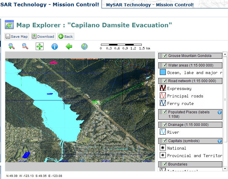
Mission Control workspaces provides online support for mission collaboration - permitting team members,
support organizations and responsible agencies to all remotely review, advise and collaborate,
over the internet, a live coordinated mission response.
![]() Mission Control displays Incident Commander Pro mission
maps - and stores map layers, assignments, briefings, reports and images in a central online location.
Ideal for planning
a coordinated mission response. Mission Control also includes a wide range of internet collaboration tools,
designed to assist in planning the mission response. These include Events, Tasks, Discussions, News, Polls, Surveys, Contacts, Email and Weblogs.
To provide a coordinated online response for your mission you are cordially invited to review
Mission Control.
Mission Control displays Incident Commander Pro mission
maps - and stores map layers, assignments, briefings, reports and images in a central online location.
Ideal for planning
a coordinated mission response. Mission Control also includes a wide range of internet collaboration tools,
designed to assist in planning the mission response. These include Events, Tasks, Discussions, News, Polls, Surveys, Contacts, Email and Weblogs.
To provide a coordinated online response for your mission you are cordially invited to review
Mission Control.
7th June 2008
 SAR Technology Inc.
releases extensive new
Datasets
SAR Technology Inc.
releases extensive new
Datasets
Comprehensive new planning datasets
for 'Incident Commander Pro' have been released that cover all
aspects of mission planning. These datasets have been thoroughly researched and field tested -
for a fast and effective mission response.
These extensive planning datasets
include: ![]() 60 Subject Profiles,
60 Subject Profiles, ![]() 70 Terrain images,
70 Terrain images,
![]() 42 Sweep Types
42 Sweep Types ![]() 95 Travel Speeds,
95 Travel Speeds,
![]() 9
Mission Plans and
9
Mission Plans and ![]() 32 Detection Tables.
32 Detection Tables.
27th April 2008
 SAR Technology Inc.
now offers
Consultation and Response Services for Search, Rescue and Emergency-Response
SAR Technology Inc.
now offers
Consultation and Response Services for Search, Rescue and Emergency-Response
SAR Technology Inc. is pleased to offer consultation and response services
for search, rescue and emergency response.
These services include project development, research, course preparation,
training, conference presentations, missions reviews and an operation response
for current incidents.
Combining scientific
methodology with years of practical field experience, SAR Technology Inc. also
offers both planning support and full operational management for current
incidents. ![]() All operational missions are supported by the latest technologies including search theory, the use of GPS, GIS-mapping and
SAR Technology's own 'Incident Commander Pro' software.
For more information please contact SAR
Technology Inc.
All operational missions are supported by the latest technologies including search theory, the use of GPS, GIS-mapping and
SAR Technology's own 'Incident Commander Pro' software.
For more information please contact SAR
Technology Inc.
22nd March 2008

Remote Desktop Assistance - Remote Customer Support and Online
Demonstrations
SAR Technology Inc.
is pleased to provide live Remote
Desktop Assistance for it's Priority Support customers.
Remote
Desktop Assistance permits ‘Incident
Commander Pro’ users to connect their computers directly to SAR
Technology Inc. for live, online technical support. With a simple email
request SAR Technology Inc. can operate your copy of ‘Incident
Commander Pro’ remotely, while you watch, permitting online training and
troubleshooting.
![]() Potential customers can also
request a live demonstration of ‘Incident
Commander Pro’, either directly onto their computers or, for group
presentations, projected onto large-format presentation screens. To request a
demonstration please contact SAR
Technology Inc.
Potential customers can also
request a live demonstration of ‘Incident
Commander Pro’, either directly onto their computers or, for group
presentations, projected onto large-format presentation screens. To request a
demonstration please contact SAR
Technology Inc.
26th
February 2008
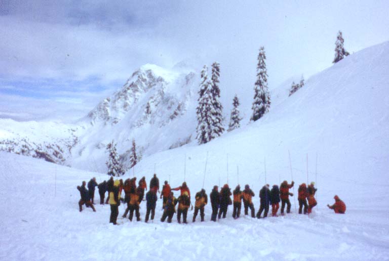
Improved Safety and Response for the Avalanche Incident
Responding to a major avalanche incident can appear to be overwhelming, with
remote locations, difficult terrain, poor weather and large avalanched areas all
hindering search progress. ‘Incident
Commander Pro’ can improve the speed and safety of the response by
combining avalanche slope mapping, safer route-finding, real-time team tracking
and accurate manpower calculations - all contributing to a faster, safer and
more effective avalanche-incident response.
21st December 2007
 Aircraft
Crash-Map Creation Service - Predicting the Crash Location of Missing
Aircraft
Aircraft
Crash-Map Creation Service - Predicting the Crash Location of Missing
Aircraft
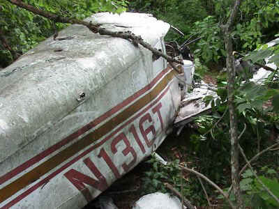
Under the circumstance where a last probable position can be estimated, for an aircraft that has lost power, it is possible to create a calculated ‘Crash Map’ of the search area. This ‘Crash Map’ is based upon the aerodynamic properties of the aircraft, the effect wind on the aircraft and on the terrain features beneath the aircraft. With this information it is possible to create a 360-degree localized ’Crash Map’ that identifies potential crash sites, for both fixed-wing and rotary aircraft.
SAR Technology Inc.
is pleased to provide the service to create calculated aircraft ‘Crash Maps’
for requesting agencies, organizations and individuals. These maps are
delivered as either detailed, geo-referenced image-maps that can be viewed
directly, or as GIS map layers that can be displayed within ‘Incident
Commander Pro’ or other standard GIS applications.
29th November 2007
 Sample
Map Files for 'Incident Commander Pro'
Sample
Map Files for 'Incident Commander Pro'
'Incident Commander
Pro' can read a wide variety of GIS map files, including seventeen vector and image map file-types. This flexibility makes it possible to quickly create
a mission map from whatever local sources of mapping data are immediately
available. A sample collection of geo-referenced map files, covering a range of
map formats, is now available on the SAR
Technology Downloads webpage. These sample files include a basic collection
of North American mapping data in the the most common map-file formats. This
collection will help users become familiar with the different map formats
available, as well as providing a useful set of basic mapping data.
11th October
2007
 Managing Missions in Remote Locations
Remote area operations present significant challenges to the on-scene commander. Long access times, limited resource availability, weather problems and navigation uncertainties frequently create difficult and challenging mission operations. 'Incident Commander Pro's unique integration of powerful location-based technologies helps ensure that the mission and field teams stay 'on track' - even in the most challenging terrain or adverse weather conditions.
17th July 2007
![]() SAR Technology Inc.
announces ‘Mission Control'! –
the online tool for planning and managing emergency-response missions.
SAR Technology Inc.
announces ‘Mission Control'! –
the online tool for planning and managing emergency-response missions.
SAR Technology Inc's new Mission Control'
website provides online support for mission collaboration - permitting team members,
support organizations and responsible agencies to all remotely review, advise and collaborate,
over the internet, on a ‘live’ coordinated mission response.
‘Mission Control’ displays ‘Incident Commander Pro’ mission maps,
assignments, briefings, reports and images, providing a central online location for planning
a coordinated mission response.
‘Mission Control’ also includes a wide range of internet collaboration tools,
designed to assist in planning the mission response. These include Events, Tasks, Discussions, News, Polls, Surveys, Contacts, Email and
Weblogs.
To provide a coordinated online response for your mission you are cordially invited to review ‘Mission Control’.
8th June 2007
 Assisting
the Air-Search Mission
Assisting
the Air-Search Mission
'Incident Commander
Pro' provides many unique features to assist with
monitoring and supporting the air-search mission. A powerful set of
integrated data, flight assignments, communications and GIS-based mapping tools provide
a comprehensive management system to assist with planning and conducting the
air-search mission.
'Incident Commander
Pro' now includes air-search Planning Templates, a sample
Air Search Mission Type, Flight Search Speed tables and ![]() Aeronautical Mapping Symbols. These
new tools provide the ability to customize air-search support for both training and operational missions.
For more information please visit Assisting
the Air-Search Mission.
Aeronautical Mapping Symbols. These
new tools provide the ability to customize air-search support for both training and operational missions.
For more information please visit Assisting
the Air-Search Mission.
1st May 2007
 GIS
Mapping Tools for 'Incident Commander Pro'
GIS
Mapping Tools for 'Incident Commander Pro'
'Incident Commander
Pro' now includes a convenient library of new mapping tools, to assist with
planning emergency-response missions. This library of customizable scalebars,
grids and planning templates are designed to work with specifically with
'Incident Commander Pro's GIS map display, to assist with planning and
responding to land, sea and air incidents. These
planning templates are provided as customizable library of CAD file map layers,
whose size, color, linestyle, font, scaling, rotation and location can be
adjusted to meet the needs of the current or pre-plan mission. For more
information, and to download these planning templates, please visit GIS
Mapping Tools for 'Incident Commander Pro'.
28th April 2007
 Planning
for the Bomb-Threat
Response
Planning
for the Bomb-Threat
Response
Planning and responding to bomb threats is an
essential part of emergency-response planning for police & fire services, governments,
corporations and institutions. At a minimum level a bomb threat warning will
distress large numbers of people, involve work disruptions, lost productivity and
the likely whole-scale evacuation of the threatened building and surrounding
areas. The worse case scenario of an actual exploded device would include
large-scale panic, major structural damage, numerous deaths and massive numbers
of casualties. Incident Commander
Pro' - now includes new Mission Plans, Subject Datasets and GIS data for Planning
for the Bomb-Threat Response.
11th March
2007
![]() New
SAR Technology
Forum for - 'Incident
Commander Pro'
New
SAR Technology
Forum for - 'Incident
Commander Pro'
SAR Technology Inc.
announces it's new
'Incident Commander Pro -
Forum'.
This newly-designed forum is a meeting place for SAR Technology users to share
information and questions regarding 'Incident Commander' & 'Incident Commander
Pro' software. With many new features, the ability to share images, web-links, email
and Instant Messaging, the
'Incident Commander Pro -
Forum' is a quick and easy way to share information and learn more about the
'Incident Commander
Pro' software.
Take a tour - your are welcome to join our forum!
1st February 2007
![]()
![]() SAR Technology Inc. releases 'Incident
Commander Pro!
SAR Technology Inc. releases 'Incident
Commander Pro!
SAR Technology Inc. is pleased to announce the release of
'Incident Commander
Pro' - the premier software tool for planning and managing search, rescue and emergency-response operations!
'Incident Commander Pro' is built upon the NIMS Incident Command System and provides a comprehensive set of Command, Operations, Planning and Logistic functions to manage search, rescue and emergency-response missions.
'Incident Commander Pro' features a powerful new GIS mapping
system, that provides a real-time status map display of every aspect of your mission.
'Incident Commander Pro's' 'Live Map' system permits you to 'Team-Track' your field assets, directly draw geographic routes and areas,
buffer routes, create a library of pre-plan and mission maps, and graphically display statistical profiles. Other important features include the ability to create multiple map overlays, plot area probabilities, export routes to GPS waypoint files and plot GPS NMEA trackfiles.
'Incident Commander Pro' displays many common GIS map formats including ESRI 'shape' files, coverages, MrSID Orthophotographs, CAD files, and georeferenced tiff, jpg and .bmp image files.
A wide range of map printing, exporting and backup capabilities provide the ability to share your customized mission maps, both electronically and in hard copy, with field responders and other supporting agencies.
29 October
2006
 Updated
Report Files available for 'Incident
Commander V5'!
Updated
Report Files available for 'Incident
Commander V5'!
-A number of 'Incident
Commander' Report files have been updated to improve multi-record, extended
text and color printing functionality. These reports include the ICS 201 Mission
Briefing,
ICS 209 Mission Status Summary, ICS 204 Assignment Form, ICS 204a Assignment
Debrief, Mission Areas, Mission Routes, Default Areas & Default
Routes. These report files are available for downloading from the SAR
Technology Downloads
webpage.
15 September
2005
 Optimizing
the Evacuation Response using 'Incident
Commander V5'
Optimizing
the Evacuation Response using 'Incident
Commander V5'
Evacuation
response plans generally have one
primary goal in mind - move as many people as fast as possible way from the
hazardous area... Incident Commander’ can be used to create an optimized
and efficient evacuation plan, maximizing the value of each transportation
resource, for a fast and dynamic evacuation response.
25 May 2005
 SAR
Technology Releases 'Incident
Commander V5' - International
Edition!
SAR
Technology Releases 'Incident
Commander V5' - International
Edition!
SAR Technology Inc. is
pleased to announce the release of 'Incident
Commander V5'!
In response to strong international demand 'Incident Commander V5' now displays
in eight languages:
- English, Spanish, French, Italian, German, Dutch, Portuguese and Swedish!
Simply select the language of choice in the Application Options and the program
will always display and print in the selected language. In addition to the new
multi-language capability the user may also select to display area and route
measurement units in either US-Imperial or Metric units. An expanded Help
capability, a new 'paper saving' Communications Log report and larger, more
detailed images on all the of the print reports, round out the improved features
and capabilities of 'Incident Commander V5' - International Edition!
24 April 2005
![]() New
'Incident
Commander V4' Network Tools available.
New
'Incident
Commander V4' Network Tools available.
'Incident
Commander V4' is commonly used
in a networked environment by the key members of the incident management team.
This permits all members of the team to share information and perform their
mission-response roles simultaneously. As an incident expands there is often a
need to quickly add more members to the management team and more computers to
the 'Incident Commander' network.
To simplify the setup and
expansion of 'Incident
Commander V4' on a Windows network two free new tools have been
created:
![]() 'Incident Commander' Client Setup is a free
utility will automatically install all of the system files required to run
'Incident Commander' on any client computer to be networked.
'Incident Commander' Client Setup is a free
utility will automatically install all of the system files required to run
'Incident Commander' on any client computer to be networked.
![]() The 'Configuring
Incident Commander For Network Use' PDF document details the steps required
to configure Windows to run 'Incident Commander' over the network.
The 'Configuring
Incident Commander For Network Use' PDF document details the steps required
to configure Windows to run 'Incident Commander' over the network.
Both of these handy new tools are available from SAR Technology's Downloads
webpage.
20 March
2005
 SAR
Technology Inc. offers a free 'Incident
Commander V4' Software Training Course
SAR
Technology Inc. offers a free 'Incident
Commander V4' Software Training Course
On the 20th May 2005 SAR Technology
Inc. will be presenting free a one day Introductory
Course on the 'Incident
Commander V4' software at the 2005 Washington State
Search & Rescue Conference
in Leavenworth, Washington State. On the 21st May 2005 there will also be a brief one-hour overview of
the 'Incident Commander V4' software.
Interested participants are invited to
attend both of these popular events.
5 December 2004
![]() SAR
Technology Inc. announces 'Incident
Commander V4' Software Release
SAR
Technology Inc. announces 'Incident
Commander V4' Software Release
SAR Technology Inc. is please to announce the release of 'Incident Commander
4.0'! This state-of-the-art, field-proven, program has been four years in design and development and incorporates a wealth of features, data and tightly integrated functionality. 'Incident Commander 4.0' provides comprehensive incident management and a rapid, efficient response to every type of search, rescue and emergency response mission.
For a general overview of the program's features please visit 'Incident
Commander 4.0'.
20 August 2004
 Six
Day Search for Alpine Hiker managed using 'Search Manager’ Software
Six
Day Search for Alpine Hiker managed using 'Search Manager’ Software
Samuel Black became lost as
poor weather enveloped the high glaciated alpine peaks of Whistler's Brandywine
Mountain range. After six stormbound days in the high alpine Samuel was
eventually rescued by a large multi-team search coordinated by Whistler SAR.
This major search was managed using the 'Search Manager'
Incident Command Software.
1
July 2004
 ‘Printing' Search Manager’ reports to PDF files.
Here is a convenient new way to share
and archive ‘Search Manager’
information. By installing a PDF
printer driver ‘Search Manager’
reports
can be printed directly to the PDF (Personal Document File) format.
This creates output to a PDF file that is an exact, formatted copy of the
original report. These PDF files (.pdf) may be printed immediately from the 'Search Manager' Print
menu, saved as permanent data backup, emailed to the responsible agency and
shared with other applications.
27
June 2004
 SAR
Technology Inc.
welcomes American Express cardholders.
SAR
Technology Inc.
welcomes American Express cardholders.
SAR Technology Inc. is pleased to announce that it now accepts
American Express credit cards. We look forward to serving American Express
customers who would like to purchase the ‘Search Manager’
Incident Command Software,
training and support services.
1 June 2004
![]() SAR
Technology Inc. now accepts US Government SmartPay Cards.
SAR
Technology Inc. now accepts US Government SmartPay Cards.
SAR Technology Inc. now accepts
US Government GSA
SmartPay credit cards.
This convenient feature permits US government GSA
SmartPay cardholders to instantly purchase ‘Search Manager’
, with no additional purchasing
paperwork required.
19 March 2004
 Spearhead
Traverse Alpine Rescue managed using the 'Search Manager’ software
Spearhead
Traverse Alpine Rescue managed using the 'Search Manager’ software
27 January 2004
![]() ‘Search Manager’ Software permits faster, more Efficient Response to the
Avalanche Incident
‘Search Manager’ Software permits faster, more Efficient Response to the
Avalanche Incident
Every winter there are a number of tragic avalanche incidents in which the search teams are unable to find the buried victims within the first few hours or days of their initial response.
Using the 'Search Manager'
Incident Command Software a more efficient
avalanche response
can now be undertaken, providing a faster and more successful resolution to the avalanche incident.
3rd December 2003
![]() SAR
Technology Inc. now accepts US Government orders through GSA Advantage!
SAR
Technology Inc. now accepts US Government orders through GSA Advantage!
After many requests from US Government agencies SAR Technology Inc. is pleased to announce that it now accepts orders through the GSA Advantage! program. This convenient feature now permits all US government agencies to purchase ‘Search Manager’ online through the GSA Advantage! website. The SAR Technology Inc. GSA schedule Contract Number is: GS-07F-5435P.
28th October 2003
 'Search Manager' Pre-Planned Mission
matches actual 'Flood of the Century'
'Search Manager' Pre-Planned Mission
matches actual 'Flood of the Century'
24th August
2003
 ‘Search Manager’ Software assists the Evacuation of 30,000 residents
fleeing Forest Fires
‘Search Manager’ Software assists the Evacuation of 30,000 residents
fleeing Forest Fires
In one of the longest and hottest summers in decades approximately 600 wild land forest fires raged across 33,000 hectares of Central British Columbia, caused approximately 30,000 residents to be evacuated from the danger areas. A State of Emergency was declared and approximately 2,000 volunteers, including many SAR teams, Firefighters and Police, worked around the clock for almost a week to assist with the evacuation. During this major incident Search & Rescue helped manage the Evacuation Response using the ‘Search Manager’ Incident Command Software.
1st August 2003
![]() Selecting
a ‘Search Manager’ Software Network Environment
Selecting
a ‘Search Manager’ Software Network Environment
Many ‘Search Manager’ software users soon decide to upgrade to a multi-user system operating within a networked environment. This greatly increases their mission management capability, permitting, for example, Personnel Check-In, Assignment Creation and operation of the Communications Log, all to be conducted simultaneously.
We are often asked to recommend a ‘Search Manager’ network environment suitable for either a fixed command post or for a mobile command vehicle.
After testing a number of network configurations we have selected two that should meets the needs of either small organizations on a limited budget or larger agencies requiring a more powerful, high-stability environment.
Information on these two recommended ‘Search Manager’ network environments can be found on the SAR Technology website at: http://sartechnology.ca/sartechnology/ST_Network_Selection.htm
We hope you will find this information helpful in setting up your network system.
9th
June 2003
 Free
Search & Rescue Screensaver!
Free
Search & Rescue Screensaver!
SAR Technology Inc. is
pleased to announce that a free SAR
screensaver is now available for download from our website! The SAR
screensaver displays dramatic images from search and rescue missions, as well as
images of command centers using our software to manage many of these missions.
The free SAR screensaver can be downloaded from SAR Technology's Download's webpage at http://sartechnology.ca/sartechnology/ST_Downloads.htm
Just unzip and run the program to have the screensaver automatically installed on your computer.
We hope you will enjoy our search and rescue screensaver!
1st June 2003
On-Line
Example Mission Demonstration
We are pleased to announce that an on-line video is now available demonstrating
an example mission managed using the 'Search Manager' Incident Command Software.
This video can now be viewed at SAR Technology's Demo's webpage at http://sartechnology.ca/sartechnology/SearchManagerV3_ExampleMission_viewlet_swf.html
The short video will show you how
a mission is created and managed using the 'Search Manager' Incident Command
Software software. We are pleased to announce that On-line
Training is now available for the 'Search Manager' Incident Command
Software! These training videos permit the rapid
learning of 'Search Manager's' basic functionality, using fast on-line tutorials
- without the need to download and install the 'Search Manager' program itself.
We hope you will find these training
videos both entertaining and instructive.
We hope you will find the video helpful and instructive.
10th
May 2003
![]() 'Search Manager'
Software On-Line Training now available.
'Search Manager'
Software On-Line Training now available.
A set of easy to view Flash training videos can now be browsed on-line at SAR
Technology's new Demo's
webpage.
1st
May 2003
![]()
![]() SAR
Technology Inc. is pleased to announce that our 'Search Manager' ICS
software,
training and Help products may now be
conveniently purchased at any time, using either Visa or MasterCard. We hope
this convenient payment method will enable our customer's to easily purchase our
products, as well as permit a rapid purchase whenever a serious SAR incident or
emergency response mission demands the immediate use of our high technology
software.
SAR
Technology Inc. is pleased to announce that our 'Search Manager' ICS
software,
training and Help products may now be
conveniently purchased at any time, using either Visa or MasterCard. We hope
this convenient payment method will enable our customer's to easily purchase our
products, as well as permit a rapid purchase whenever a serious SAR incident or
emergency response mission demands the immediate use of our high technology
software.
15th
March 2003
 Greetings,
Saludos, Salutations, Saluti, Grusse - from the 'Search Manager' Incident
Command software
Greetings,
Saludos, Salutations, Saluti, Grusse - from the 'Search Manager' Incident
Command software
SAR Technology Inc. is please to announce that, in response to many
requests, introduction information on the 'Search Manager' ICS software is now
available in:
English![]() Introduction
, Spanish
Introduction
, Spanish![]() Introducción,
French
Introducción,
French![]() L'introduction
, Italian
L'introduction
, Italian![]() Introduzione
and German
Introduzione
and German ![]() Einführung.
Einführung.
26th January 2003
 Ontario Provincial Police Emergency Response Team use 'Search Manager' Software
Tim Charlebois is a staff sergeant with the Ontario Provincial Police and head of the provincial emergency response team. It's a highly capable squad, consisting of 240 officers spread across the province, with resources such as helicopters and fixed-wing aircraft at its disposal.
It is Charlebois's job to co-ordinate all ground searches in Ontario. Last year, his team conducted 205 missions, up 10% from 2001. Only a handful involve people participating in extreme sports. Lately, he says, there has been a noticeable rise in the number of people with Alzheimer's requiring SAR assistance.
"They represent a growing segment of the population, so it seems sort of natural that we see more of them getting lost," he says. "They'll wander away from a nursing home and because they are already disoriented, they can find themselves in trouble quite quickly. It's not like they are participating in an extreme sport or anything. But we treat them the same as any lost person."
In almost every lost-person case, a friend, relative or caregiver alerts the police. As is the case with almost all search-and-rescue efforts in Canada, local volunteers are called in to assist authorities. Most help out on the ground; however, there are SAR volunteers in almost every region of Canada with access to airplanes and watercraft. If the lost person is not found within 72 hours, the case is forwarded to Charlebois's office in Orillia, north of Toronto, and emergency response officers are dispatched.
"It's a very scientific process just to determine where to search," Charlebois says.
"All our officers use electronic mapping technology, global positioning satellite technology and laptop computers that deploy
[the 'Search Manager' software's] mathematical formulas in the effort to narrow a search field."
Once his team is involved, he says, a search will end successfully after about 12 hours.
23rd November 2002
 'Search Manager' Software helps police solve old 'Cold Squad' cases.
Twice in the last few months SAR teams have helped police resolve old 'Cold
Squad' missing person cases, using the 'Search Manager' ICS
software. The software's powerful Gridsearch Calculator was used in both
searches to determine the optimum manpower required to search a series of
densely wooded areas, resulting, in both cases, with successful 'finds'.
20th September 2002
 Major
wilderness search managed using 'Search Manager' ICS Software.
Major
wilderness search managed using 'Search Manager' ICS Software.
When two hikers went missing on the steep and remote Mount
Elizabeth, in Northwest British Columbia, 'Search Manager' was used to plan
and manage this difficult search. Mount Elizabeth stands at the centre of a complex
system of major drainages, with alpine peaks, connecting ridges, pocket
glaciers, seracs, headwalls and five long, forested wilderness valleys, all
radiating out from it's main summit.
Using the Search
Manager ICS software over 200
people from 16 SAR teams were checked-in, software-generated ID tags
were issued, 91 mission search
areas defined and 78
new assignments created, for a total of
approximately 120 assignments. Four IT people were dedicated to maintaining
software data entry throughout the mission. 'Search Manager's' Communications
Log was used to track all mission communications and to
document any clues found. As each search team reported back to base their
Probability of Detection was recorded in the software. All of the 91 mission search areas were then automatically
updated for shifting Probability of Area and then instantly re-prioritized according
to the software's Search Priority.
20th June 2002
Two
major searches in one week Stress-Test the 'Search Manager' Software.
Poor mountain weather conditions caused two lone hikers to become lost within one
week. Local SAR teams responded to these tough SAR missions,
stress-testing the Search Manager; ICS software.
18th April 2002
Sherbrooke Police SAR Team praise the 'Search Manager' Software!
![]()
The Sherbrooke Police SAR Team have reached new heights using the 'Search
Manager' ICS software. Read the story of
their success as recently published in Cyberpresse!
15th March 2002
SAR Technology Inc. - new Website Address, Conference Presentation!
![]() New, simpler website address:
New, simpler website address:
SAR Technology Inc. is pleased to announce a new, simpler
website address for it's 'Search Manager' ICS software. The new web address is http://sartechnology.ca
- Don't forget to update your internet bookmarks.
![]() Washington State SAR
Conference Presentation:
Washington State SAR
Conference Presentation:
SAR Technology Inc. will be making an exciting new software
presentation:
'From Pre-Plan to Response in Sixty
Seconds' - at the Washington State SAR
Conference,
May 17-19th, 2002 at Stabler, Skamania County, Washington State.
I hope we have the opportunity to meet you at the conference!
23rd November 2001
'Search Manager' Software makes TV Headline News!
![]() 27.5MB
27.5MB ![]() 7.1MB
7.1MB
 The unique 'Search Manager' software made headline news recently when
it was used to network five Search & Rescue Command Vehicles together. This
powerful database software makes it possible for these mutual-aid SAR teams to share their
information and jointly manage and coordinate a major SAR or urban-response mission. To
view this headline news story please click on either the MPEG
27.5MB or QuickTime 7.1MB link. We hope you enjoy the story!
The unique 'Search Manager' software made headline news recently when
it was used to network five Search & Rescue Command Vehicles together. This
powerful database software makes it possible for these mutual-aid SAR teams to share their
information and jointly manage and coordinate a major SAR or urban-response mission. To
view this headline news story please click on either the MPEG
27.5MB or QuickTime 7.1MB link. We hope you enjoy the story!
28th October 2001
 The world changed on September 11th 2001... The terrorist
attacks on the World Trade Center reminded us that Emergency Responders and Planners
throughout the world have to be prepared and ready to respond to attacks on our cities,
institutions and facilities.
The world changed on September 11th 2001... The terrorist
attacks on the World Trade Center reminded us that Emergency Responders and Planners
throughout the world have to be prepared and ready to respond to attacks on our cities,
institutions and facilities.
 To meet this new challenge SAR Technology Inc. is pleased to announce the new
'Emergency Responder Discount Program' for it's 'Search
Manager' Incident Command Software. This discount program is designed to support all levels of
government agencies involved in the planning, management and delivery of emergency
response services.
To meet this new challenge SAR Technology Inc. is pleased to announce the new
'Emergency Responder Discount Program' for it's 'Search
Manager' Incident Command Software. This discount program is designed to support all levels of
government agencies involved in the planning, management and delivery of emergency
response services.
![]() For a limited time only SAR Technology Inc. is pleased to offer government
agencies it's 'Search Manager'
Incident Command Software for
the discount price of only $950 US - a significant saving on this high-tech
emergency-response software!
For a limited time only SAR Technology Inc. is pleased to offer government
agencies it's 'Search Manager'
Incident Command Software for
the discount price of only $950 US - a significant saving on this high-tech
emergency-response software!
For more information see SAR Technology's new Emergency Responders Discount Program.
13th October 2001
![]() Expanded 'Help' features for 'Search Manager' software
Expanded 'Help' features for 'Search Manager' software
Many 'Search Manager' users have asked for additional
information on how to setup, network and backup their copies of 'Search
Manager'. To assist in these important functions the 'Search Manager V3'
Help facility has been expanded to include more detailed information on
these topics. You may view and download the latest 'Search Manager V3'
Help files from the SAR Technology Downloads webpage.
22nd August 2001
![]() SAR Technology Inc. announces
it's Charitable Discount Program!
SAR Technology Inc. announces
it's Charitable Discount Program!
SAR Technology Inc. has received enthusiastic support from users of its new 'Search
Manager V3' software from all across North America. Many SAR teams and
agencies have now adopted 'Search Manager' to manage their SAR operations and to maintain
their SAR Resource Lists.
While many SAR organizations have adequate funding to support their operations a number of
smaller non-profit and charitable societies have asked for a special price-break to help
them purchase 'Search Manager V3'.
SAR Technology recognizes the valuable
contribution of SAR non-profit and charitable societies and has
agreed to provide a major price-break in support of these organizations. For more information see SAR Technology's new Charitable Discount
Program.
12th August 2001
![]() A group of SAR teams in B.C.'s Lower Mainland are planning to
hold their first major Command
Vehicle Training Exercise using the newly-released 'Search Manager'
software.
A group of SAR teams in B.C.'s Lower Mainland are planning to
hold their first major Command
Vehicle Training Exercise using the newly-released 'Search Manager'
software.
 The joint team exercise, to
be held on Sunday, September 9th 2001 in Maple Ridge, B.C, will bring together many of the local SAR teams,
each bringing their new or recently refurbished command vehicles, all now equipped with
computers for running the new 'Search Manager' software.
The joint team exercise, to
be held on Sunday, September 9th 2001 in Maple Ridge, B.C, will bring together many of the local SAR teams,
each bringing their new or recently refurbished command vehicles, all now equipped with
computers for running the new 'Search Manager' software.
 All of the command vehicles will be networked together to
permit each SAR team's command staff to simultaneously share and manage the search mission
using the 'Search
Manager' software.
All of the command vehicles will be networked together to
permit each SAR team's command staff to simultaneously share and manage the search mission
using the 'Search
Manager' software.
See SARINFO's Calendar for more information.
3rd July 2001
 SAR Technology Inc. has received a number of urgent
requests from SAR organizations seeking a rapid means of purchasing 'Search Manager' while
they are conducting an active SAR mission.
SAR Technology Inc. has received a number of urgent
requests from SAR organizations seeking a rapid means of purchasing 'Search Manager' while
they are conducting an active SAR mission.
Many SAR teams and Responsible Agencies, while managing a difficult SAR mission,
have access to emergency-operations funds to immediately respond to the incident. For this
critical time SAR Technology has developed the 'Mission-Critical' Purchase Plan -
permitting the 'Search Manager' software to be rapidly purchased and activated, to assist
with the ongoing mission.
9th May 2001
'Search Manager' software training
for the U.S. National Park Service
 At the
request of the U.S. National Park Service a SAR Technology 'Search Manager' software
training course was recently presented.
At the
request of the U.S. National Park Service a SAR Technology 'Search Manager' software
training course was recently presented.
U.S. Parks Service personnel from both the Olympic National Park and Mount
Rainier National Park recently completed a 3-day Advanced Search Manager Software
Training Course, at Longmire, Washington State.
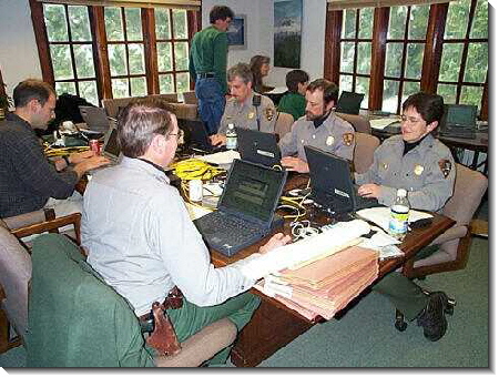
In the Park Headquarters building, beneath the massive bulk of Mount Rainier, approximately 15 persons learnt first the basics and then the more advanced elements of the 'Search Manager' software.
By the end of the second day Parks
personnel had setup eleven laptop computers in two networks and were jointly managing SAR
missions using the 'Search Manager' software. By the end of the third 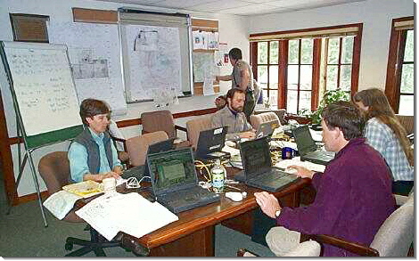 day the entire class of fifteen were managing a re-creation
of a major 7-day urban SAR operation. The fresh snowfall of the first two days gave
way to clearing skies and a magnificient view of Mount Rainier - a major distraction form
the classroom window!
day the entire class of fifteen were managing a re-creation
of a major 7-day urban SAR operation. The fresh snowfall of the first two days gave
way to clearing skies and a magnificient view of Mount Rainier - a major distraction form
the classroom window!
The course concluded with an elite core
of Parks Service personnel trained to use 'Search Manager' to manage many kinds of
incidents within the parks, ranging from quick-response SAR operations, to general
ICS-based incidents - such as flooding and wildfires - all the way up to managing major
multi-day SAR operations involving many agencies and hundreds of volunteer searchers.
6th April 2001
'Search Manager' software is now
available!
 After five years
of development, numerous field trials, countless hours of testing and the unfailing
support of the SAR community 'Search Manager V3.0' is now complete!
After five years
of development, numerous field trials, countless hours of testing and the unfailing
support of the SAR community 'Search Manager V3.0' is now complete!
The 'Gold' Master CD of 'Search Manager' was delivered this week to make the first
production run.
We would like to thank all those kind persons who have made useful suggestions,
beta-tested, contributed information and generously encouraged us through the arduous task
of bringing this major application to its successful completion. Thank you all.
The latest, complete demo of 'Search Manager' may
now be downloaded from SAR Technology's Downloads webpage.
After trying out the demo it may then be registered with SAR Technology, at which time you
will be provided with your fully-functioning version of 'Search Manager V 3.0'
- Your SAR operations will be entering a whole new era of computer technology!
28th February 2001
'Search Manager' software being
readied for public release.
We are pleased to announce that the final development phase of the 'Search Manager' software is now complete! All of the major phases - design, program coding, network functionality, hard copy output, beta testing and documentation have now been completed.
Within the next short while we will be packaging 'Search Manager' into the format ready for public release. At this time we will make an announcement of the official Software Release Date through the SAR Technology website and various SAR email lists.
We would like to thank the many people who have encouraged and supported us through this challenging development project. We hope that you will enjoy using 'Search Manager' as much as we have in developing this exciting and unique SAR software product.
29th October 2000
'Search Manager' software used to
manage Major Urban Search
The search for 10 year-old Heather Thomas, who
went missing on Sunday October 1st 2000, outside her fathers apartment in Cloverdale,
British Columbia, was planned and managed using SAR Technology's 'Search Manager'
software.
During the initial three operational periods, through Sunday night, Monday and Tuesday,
'Search Manager' was used to Check-In personnel, create Mission Search Areas and log all
the field communications, using the Communications Log. Approximately 600 people were
managed during these three initial operational periods using the 'Search
Manager' software.
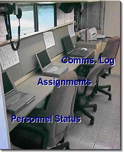
 < Operations Plan for the
Heather Thomas Search
< Operations Plan for the
Heather Thomas Search
The biggest challenge came three days later, on Friday 6th October 2000, when the Royal
Canadian Mounted Police requested, through the media, for the public to assist with the
search for Heather Thomas. In preparation for the expected large public response 'Search
Manager' was used to pre-plan and create 73 Mission Search Areas.
During the morning hours of Saturday October 7th a huge crowd of public showed up to
assist with the search. Approximately 1200 persons - 1050 public and 150 SAR/Police/Fire
persons - were all checked-in, using the software's ICS 211 Check-In screen.
Six laptop computers were networked together to keep up with the very heavy check-in,
planning and communications demand. During this fourth operational period 125 assignments
were created and documented using 'Search Manager' - we were
creating assignments continuously for twelve hours - at the rate of one new assignment
every six minutes! All 86 team call-signs and all the radio communications, on four radio
channels, were monitored using 'Search Manager's Communications Log.
 Communications
Log for the Heather Thomas Search >
Communications
Log for the Heather Thomas Search >
During the morning hours three to four laptop computers were used to Check-In personnel,
one to create Assignments and one to record the Communications Log. Towards late afternoon
all six laptops were used to check-out all of the 1200 search personnel - a truly major
task!
By nightfall the urban search was completed, unfortunately without finding any sign of
Heather Thomas. the 'Search Manager' software performed smoothly
throughout the entire operation, helping to manage one of British Columbia's largest
search operations in an efficient and well-organized manner, without any major stalls or
interruptions.
Lessons learned from this major urban search include:
![]() 1. Pre-enter the Mission Search
Areas into the software.
1. Pre-enter the Mission Search
Areas into the software.
![]() 2. Create Assignments in the
software prior to the upcoming operational period.
2. Create Assignments in the
software prior to the upcoming operational period.
![]() 3. Have the laptops
pre-configured for networking.
3. Have the laptops
pre-configured for networking.
![]() 4. Use a UPS (Uninteruptable
Power Supply) for dependable power stability.
4. Use a UPS (Uninteruptable
Power Supply) for dependable power stability.
![]() 5. Assign a dedicated management
team to keep track of the mission using the 'Search Manager'
software.
5. Assign a dedicated management
team to keep track of the mission using the 'Search Manager'
software.
25th July 2000
A pre-release field trial has
been undertaken for the new Search Manager V3 software!
Prior to its full public release a small group of selected SAR teams have been
given copies of Search Manager V3 to try out on their local SAR missions. Comments and
suggestions from this pre-release field trial will be used to fine-tune Search Manager
before its full public release.
Providing evaluation copies of Search Manager to these selected SAR teams marks the last
major milestone in the program's development and a unique opportunity to share these
exciting developments with the SAR community.
14th May 2000
As Search Manager moves towards the release of Version 3 we have added a number
of new features to add convenience and flexibility to the program.
Quick Start Wizard:
An-easy-to use Quick Start Wizard can guide you through the basic
steps necessary to create and manage a mission. The wizard tells you which steps have been
'done', will quickly prepare a Communications Plan and automatically load lists of Mission
Search Areas and Mission Trails. Once you have created the assignments your ready to run
the Communications Log - your mission is underway!
Quick Tips:
A handy Quick Tips display lists short, useful hints on how to get
the best performance from the Search Manager program. - A quick and easy alternative to
reading the Help files!
ICS Notepads:
Each major ICS menu function has been given its own Notepad: a
Command Notepad, Operations Notepad, Planning Notepad, Logistics Notepad and a
Calculations Notepad. All the notepads have a separate heading for each note entry.
Permanent Notebook:
A 'Permanent Notebook' has been added to the Data menu. This
notebook is 'program-wide' and is available whenever 'Search Manager' is open. The
notebook allows an unlimited number of entries, each with its own title and details,
defined by the user. This notebook is handy for storing any user-defined information
including, for example, callout procedures, equipment checklists,response protocols,
maintenance procedures etc.
![]() Latest Feature Enhancements
Latest Feature Enhancements
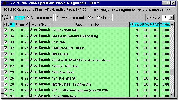
- The ICS 215 Operations Plan
now displays the number of Active Assignments and the Total Number of Assignments within
the selected operational period. This feature provides improved monitoring of the scope
and progress of the mission.
- The Personnel Status Display now lists the Role (Command, Operations and Support) of each checked-in person and permits sorting of the display by Team/Agency, as well as by Name. Team/Agency sorting makes it easy to see which persons are present from each Team/Agency and permits people to be rapidly allocated to assignments based on their Team/Agency affiliation.
- The Screen Background Image
function now provides four different ways to display the background image. These options
provide improved display options for team logos, photographs, portraits and topographical
maps.
These new features help 'round out' the convenience of the Search Manager program as
we move towards the release of Version 3.
For more information please
contact:
![]() SAR
Technology Inc.
SAR
Technology Inc.
 Phone:
(604) 921-2488
Phone:
(604) 921-2488  Fax
(604) 921-2484
Fax
(604) 921-2484 ![]() sartechnology@telus.net
sartechnology@telus.net
 |
SAR Technology Inc. |  |
View / Save / Share |