![]()
![]()
![]() 'Incident Commander
Pro - Version 8'
'Incident Commander
Pro - Version 8'
- Program Overview -
'Incident Commander
Pro' is the premier software program for
managing search, rescue and
emergency response missions. Built on the NIMS Incident Command System, and based
upon years of
practical experience, 'Incident
Commander Pro' provides a field-proven set of Command, Operations,
Planning, Logistic and ![]() GIS-Mapping
functions to manage every type of emergency-response mission.
GIS-Mapping
functions to manage every type of emergency-response mission.
|
|
|
|
Follow the links to each section of the program
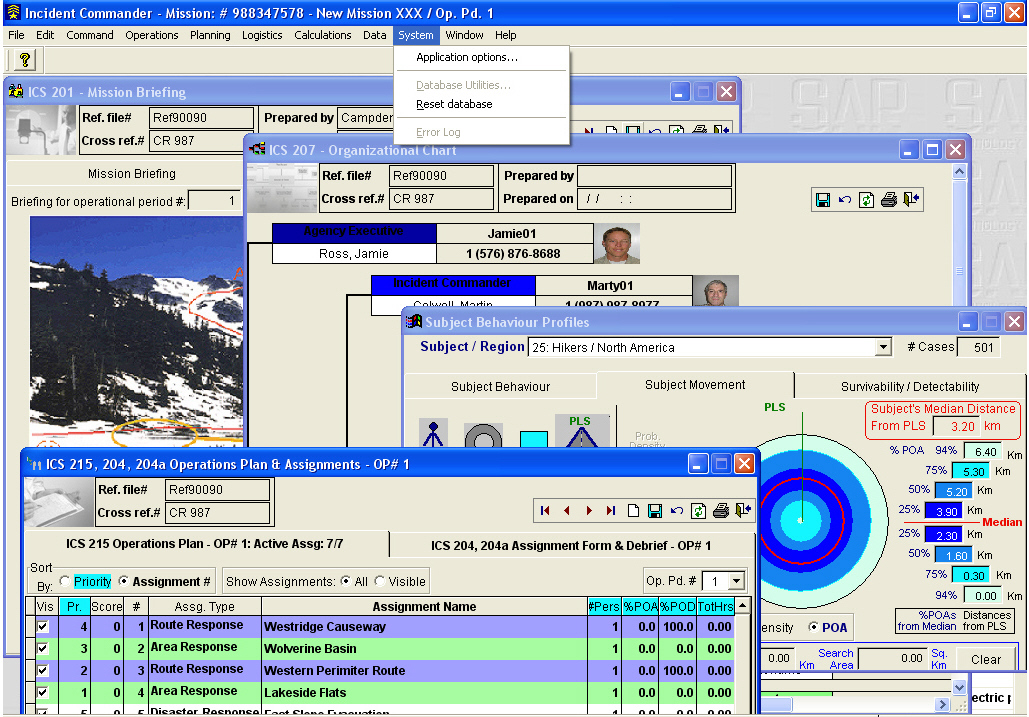 |
- Mission Briefing - Organizational Chart - Operations Plan - Subject Behavior Profiles
|
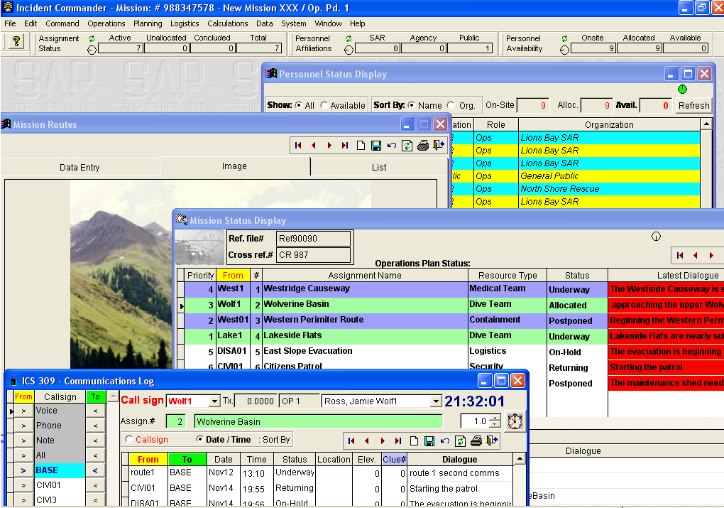 |
- Mission Statistics - Personnel
- Mission
|
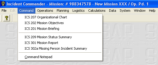 |
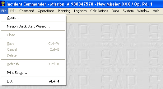
The Command Menu contains forms for directing the general organization, objectives, briefings and reporting of the mission. |
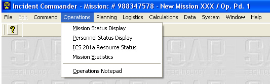 |
The Operations Menu contains automatically updating 'live' status displays, for monitoring the real - time status of the mission. |
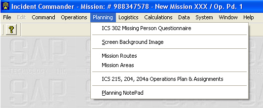 |
The
Planning Menu contains forms for documenting planning,
|
 |
|
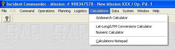 |
The Calculations Menu's calculators determine Gridsearch time and manpower requirements, UTM / LatLong conversions and numeric calculations.
|
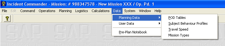 |
The Planning Data Menu contains extensive POD tables, Subject Behavior Profiles, Travel Speed & Mission Type data.
|
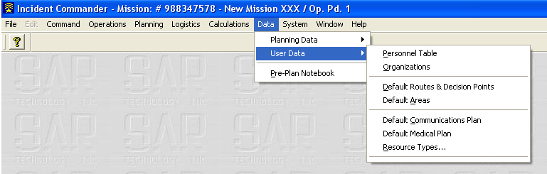 |
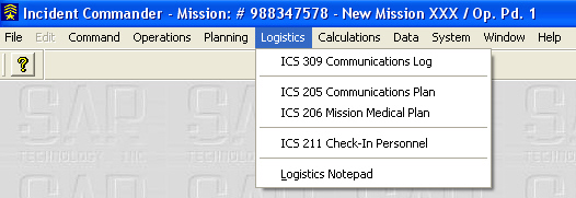
The User Data Menu
contains the user's Personnel information, Organizations, Routes, Areas,
Medical and Communications, Plans |
|
|
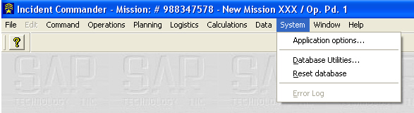
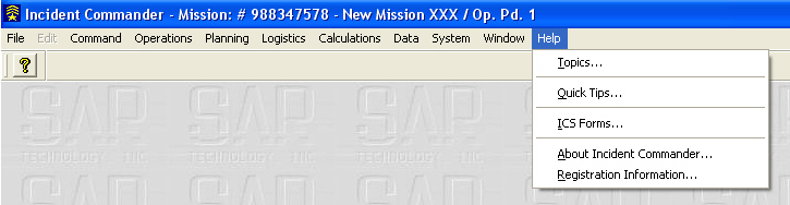
The Help menu contains extensive Help information, Quick Tips and General Information. |
Additional Program Features...
![]() - Selectable Background - including maps,
images & organization logo
- Selectable Background - including maps,
images & organization logo
For more information please
contact:
![]() SAR
Technology Inc.
SAR
Technology Inc.
 Phone:
(604) 921-2488
Phone:
(604) 921-2488  Fax
(604) 921-2484
Fax
(604) 921-2484 ![]() sartechnology@telus.net
sartechnology@telus.net
 |
SAR Technology Inc. |  |
View / Save / Share |