![]()
![]()
![]() 'Incident Commander
Pro - Version 8'
'Incident Commander
Pro - Version 8' 
-
Avalanche Response -
For a Faster, Safer Response to an Avalanche
Incident
 |
|
Conduct a faster Avalanche Response |
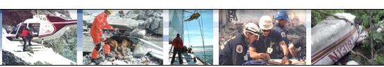
![]() With
increased winter recreational activities, skiers, climbers, snowshoers,
snowmobilers and people working in the backcountry are frequently exposed to the
risk of avalanches. Every winter there are numerous avalanche incidents, including
those where the
rescue teams are unable to find
the buried victims within the first few hours or days of their initial response. This frequently leads to
significant pain for the families of the victims and considerable discomfort for the search teams, who
often report that their efforts have been ‘like searching for a needle in a haystack'.
With
increased winter recreational activities, skiers, climbers, snowshoers,
snowmobilers and people working in the backcountry are frequently exposed to the
risk of avalanches. Every winter there are numerous avalanche incidents, including
those where the
rescue teams are unable to find
the buried victims within the first few hours or days of their initial response. This frequently leads to
significant pain for the families of the victims and considerable discomfort for the search teams, who
often report that their efforts have been ‘like searching for a needle in a haystack'.
 |
|
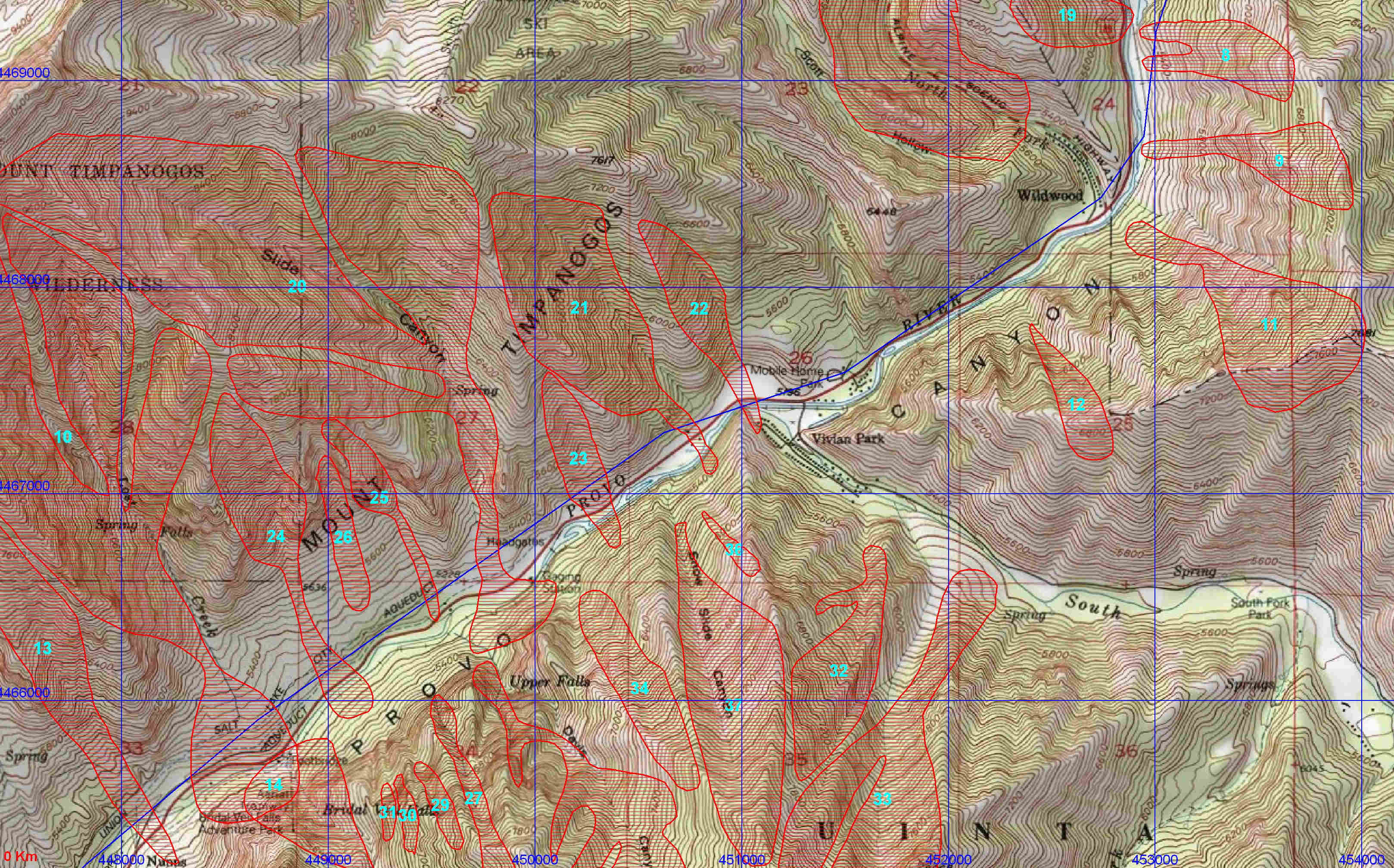
'Incident Commander Pro' Digital Avalanche Map - Provo Canyon, Utah |
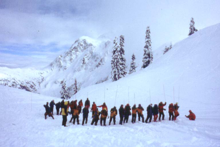
![]() Responding to a major avalanche incident can appear to be overwhelming, with
remote locations, difficult terrain, poor weather and large avalanched areas all
contributing to a relatively slow rate of search progress.
Responding to a major avalanche incident can appear to be overwhelming, with
remote locations, difficult terrain, poor weather and large avalanched areas all
contributing to a relatively slow rate of search progress.
Common challenges to these
avalanche-response incidents
typically include:
![]() A lack of accurate digital maps of known high-risk avalanche slopes for common
winter recreation areas.
A lack of accurate digital maps of known high-risk avalanche slopes for common
winter recreation areas.
![]() Precise real-time tracking of the rescuers, to monitor and track their
locations, in case of further avalanches.
Precise real-time tracking of the rescuers, to monitor and track their
locations, in case of further avalanches.
![]() Accurate
calculations of the resources required to successfully complete the search of the avalanched
slope.
Accurate
calculations of the resources required to successfully complete the search of the avalanched
slope.
![]()
Fortunately many of these challenges
can now be rapidly resolved using the 'Incident Commander Pro' software...
 |
|
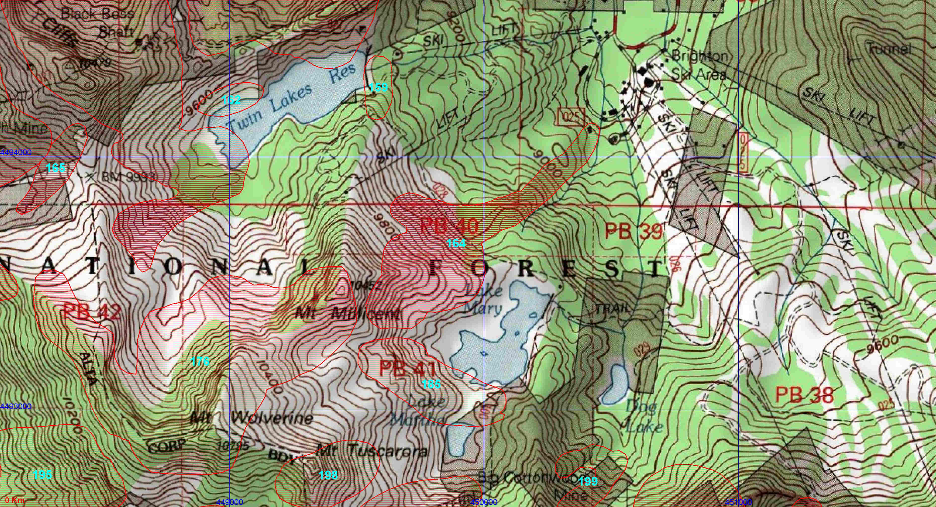
'Incident Commander Pro'
Digital Avalanche Map - Cottonwood Canyon, Utah |
![]() Accurate digital maps of known avalanche slopes can be quickly created using 'Incident
Commander Pro'. It's powerful digital map
module can combine map images, detailed aerial photographs and map-layers of
known avalanche slopes. Using the integrated mapping tools the size of the
avalanched area can be quickly measured and this information used to accurately
calculate the precise manpower requirements.
Accurate digital maps of known avalanche slopes can be quickly created using 'Incident
Commander Pro'. It's powerful digital map
module can combine map images, detailed aerial photographs and map-layers of
known avalanche slopes. Using the integrated mapping tools the size of the
avalanched area can be quickly measured and this information used to accurately
calculate the precise manpower requirements.
|
|
|
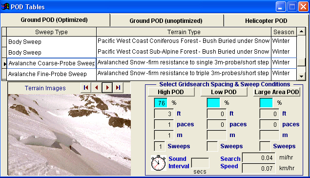
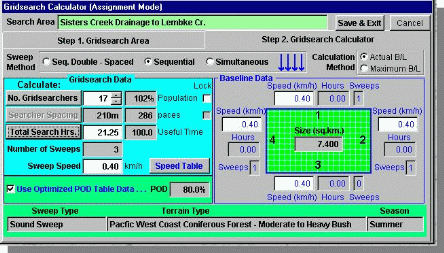
Gridsearch Manpower Calculator: |
 |
|
Gridsearch Manpower Calculator: |
![]() SAR
Technology's
SAR
Technology's
![]() 'Track
Commander'
app provides live, real-time tracking of the rescue teams. This
precise plotting of the rescuers movements in the field provides additional
safety for the rescuers, where they may be exposed to bad weather, poor
visibility and the threat of additional avalanches.
'Track
Commander'
app provides live, real-time tracking of the rescue teams. This
precise plotting of the rescuers movements in the field provides additional
safety for the rescuers, where they may be exposed to bad weather, poor
visibility and the threat of additional avalanches.
![]() 'Incident Commander Pro's
powerful Gridsearch Calculator utilizes up to twelve search variables to create
a precise response plan, with known timelines and firm manpower requirements. This scientifically created plan,
combining accurate search maps with precise manpower calculations,
permits the responding search teams to conduct faster, more effective and safer
searches for the avalanched victim.
'Incident Commander Pro's
powerful Gridsearch Calculator utilizes up to twelve search variables to create
a precise response plan, with known timelines and firm manpower requirements. This scientifically created plan,
combining accurate search maps with precise manpower calculations,
permits the responding search teams to conduct faster, more effective and safer
searches for the avalanched victim.
![]() 'Incident
Commander Pro' provides a faster, safer response to the avalanche incident.
'Incident
Commander Pro' provides a faster, safer response to the avalanche incident.
For more information
please contact:
![]() SAR
Technology Inc.
SAR
Technology Inc.
 Phone:
(604) 921-2488
Phone:
(604) 921-2488  Fax
(604) 921-2484
Fax
(604) 921-2484 ![]() sartechnology@telus.net
sartechnology@telus.net
Data courtesy of AvalancheMapping.org