![]()
![]()
![]() SAR
Technology - 'Mission Control' Online Map Viewer
SAR
Technology - 'Mission Control' Online Map Viewer![]()
 'Mission
Control' - Online Collaboration for Response Teams & Agencies.
'Mission
Control' - Online Collaboration for Response Teams & Agencies.
![]() Sharing documents, data, images, map layers and
mission maps.
Sharing documents, data, images, map layers and
mission maps.
 |
|
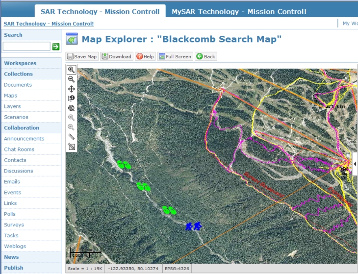
'Mission
Control' Online Map Explorer |
 |
|
Mission
Control' - Full-Screen Online Map Viewer |
 |
|
Mission
Control' - Full-Screen Online Map Viewer |
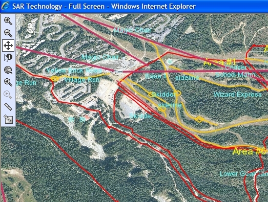
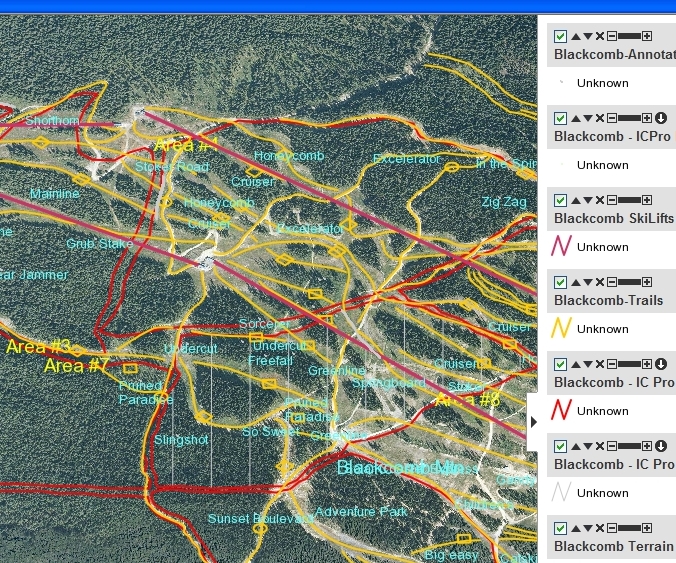
![]() The 'Mission
Control' website now displays uploaded 'Incident Commander
Pro' maps in a
new, feature-rich, full-screen map display.
The 'Mission
Control' website now displays uploaded 'Incident Commander
Pro' maps in a
new, feature-rich, full-screen map display.
![]() The new full-screen map display is ideal for sharing mission information
between response teams and agencies, even when collaborating from different geographic locations.
The new full-screen map display is ideal for sharing mission information
between response teams and agencies, even when collaborating from different geographic locations.
The full-screen map display now permits detailed online examination of 'Incident Commander Pro' mission status maps - a powerful capability for remote conferencing and planning by response team and agencies.
![]() The
enhanced 'Mission
Control' map display includes many convenient
new features for collaborative planning and response:
The
enhanced 'Mission
Control' map display includes many convenient
new features for collaborative planning and response:
![]() The Map Control features include:
The Map Control features include:
![]() Zoom
In
Zoom
In ![]() Zoom
Out
Zoom
Out
![]() Pan
Pan
![]() Identify
Features
Identify
Features
![]() Zoom
to Map Limits
Zoom
to Map Limits
![]() View
Previous
View
Previous ![]() View
Next
View
Next
![]() Measure
Length
Measure
Length ![]() Measure
Area
Measure
Area
![]() The Map Layer features include:
The Map Layer features include:
![]() Show/Hide
Layer
Show/Hide
Layer
![]() Move
Layer Up/Down
Move
Layer Up/Down
![]() Remove
Layer
Remove
Layer
![]() Set
Layer Transparency
Set
Layer Transparency
![]() Download Map Layer
Download Map Layer
![]() Lat-Long
Lat-Long
![]() Map Scale
Map Scale ![]() Map Datum
Map Datum
![]() Identify
Features
Identify
Features ![]() Map Properties
Map Properties
![]() Metric
/ US Map Ruler
Metric
/ US Map Ruler
![]() 'Incident
Commander Pro' & 'Mission
Control'
'Incident
Commander Pro' & 'Mission
Control'
Collaborative Mission Response
For more information
please contact:
![]() SAR
Technology Inc.
SAR
Technology Inc.
 Phone:
(604) 921-2488
Phone:
(604) 921-2488  Fax (604) 921-2484
|
|
SAR Technology Inc. |  |
View / Save / Share |