![]()
![]()
![]() 'Incident Commander
Pro - Version 8'
'Incident Commander
Pro - Version 8'

- Mapping Features -
Now with
![]() Global Earth Tools!
Global Earth Tools!
for Google Earth ![]()
 |
'Incident Commander
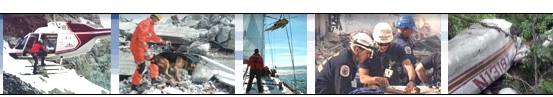
Pro' V8 is the premier software program for Search, Rescue, Safety,
Security and Emergency-Response.
Version 8 is the fastest, most
capable release yet - offering a host of features for enhanced planning,
mapping, tracking, response and connectivity. |
|
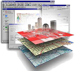
Powerful
GIS Mapping Engine |
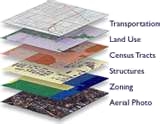
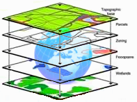
A powerful GIS mapping engine delivers high speed and advanced GIS mapping features. Supported by Microsoft's acclaimed .NET framework the GIS engine delivers fast and reliable mapping performance. |
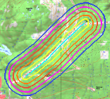 |
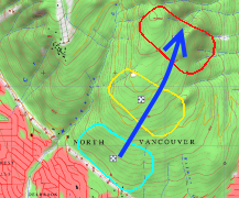
Buffer Zones | Up to ten user-defined buffer-lines can be added to routes drawn on the map. Buffer lines can be used to display visibility distances, safe buffer-zones, coverage regions, probability distances etc |
|
Visualize
in Google Earth |
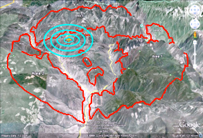
Custom features drawn on the map - lines, polygons, labels, symbols, areas and routes - can all be easily exported to Google Earth. This permits detailed planning, prepared on the map, to then be displayed in Google Earth. This powerful feature blends the advanced planning tools of 'Incident Commander Pro' with the enhanced 2D and 3D visualization of Google Earth. |
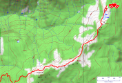 |
GPS Track Display | GPS track-files can be immediately displayed on the map in their native, high resolution, GPX format. Each GPS track can be individually saved and displayed, providing a detailed track-map of all the GPS tracks created. |
 |
Geo-Located Map Symbols |
Map symbols can be placed at any selected location - or at a specific geographic location - on the map. GPS locations provided from the field, e.g. from response personnel, helicopters etc., can be directly entered into the Map Symbols form, which will then display the symbols on the map at this precise GPS location. |
 |
Move Features | Many features drawn on the map -such as lines, polygons, labels, symbols, areas and routes - can now be easily moved after drawing. This convenient feature enables labels to be precisely located, track symbols to be moved to follow changing field locations and defined areas and routes to be easily relocated or shifted. |
|
Multiple Map Formats | The mapping module supports an extensive range of map formats - 27 formats are supported, including the popular jpg, jpg2000, tif, gif, .png, MrSID, ecw, shapefile (shp) and digital elevation model (dem) formats. |
 |
Web Map Services | 'Incident Commander Pro's new mapping engine supports the powerful internet-based Web Map Service. A list of WMS websites is included that deliver pre-formatted map layers, ready for immediate display. WMS also includes live, real-time mapping data - such as hurricane-path maps, wildfire location maps etc. |

|
Map
Auto-Backup and Recovery |
Automated map backups create a continual set of backup maps that can be restored at any time. Both complete map datasets and geo-referenced map images can be restored, providing increased confidence and reliability under challenging operational conditions. |

|
Enhanced Map Printing | The enhanced map printing function enables many options to be selected, including Legend, North Arrow and Scalebar. Full-page maps can be printed in either Landscape and Portrait mode, ideal when the main map features are primarily in either an East-West (Landscape) or North-South (Portrait) layout. |
|
|
How-To
Video: Create a Map in 'Incident Commander Pro' |
Video shows how to create a map and add map layers in 'Incident Commander Pro' V8 |
![]() View PDF:
'Incident
Commander Pro' Brochure & 'Incident
Commander Pro - Details' Brochure
View PDF:
'Incident
Commander Pro' Brochure & 'Incident
Commander Pro - Details' Brochure
Program
Features...
![]() GIS
Mapping
GIS
Mapping  Mobile
Tracking
Remote
Alerts GPS
Plotting Export
to Google Earth Message
Centre
Mobile
Tracking
Remote
Alerts GPS
Plotting Export
to Google Earth Message
Centre
GPS-Radio
Tracking
InReach/Spot
Beacon Tracking Smartphone
Tracking
Connected-GPS
Tracking
![]() Skills
Custom
Skills Training
Equipment
Barcodes
External
Programs
Skills
Custom
Skills Training
Equipment
Barcodes
External
Programs
Import/Export
Coverage/POD
Calculator
Expanded
Datasets Enhanced
Reporting
For more information please
contact:
![]() SAR
Technology Inc.
SAR
Technology Inc.
 Phone:
(604) 921-2488
Phone:
(604) 921-2488  Fax
(604) 921-2484
Fax
(604) 921-2484 ![]() sartechnology@telus.net
sartechnology@telus.net
 |
SAR Technology Inc. |  |
View / Save / Share |