
![]() SAR Technology: 'Incident
Commander Pro' Software
SAR Technology: 'Incident
Commander Pro' Software
 GIS
Mapping Tools
- for the Emergency-Response Mission
 |
|
Scalebars & Grid on GIS map image |
![]() 'Incident Commander Pro'
provides unique GIS planning functionality, supports a wide range of map
formats and includes a convenient library of mapping tools, to assist with
planning the emergency-response mission.
'Incident Commander Pro'
provides unique GIS planning functionality, supports a wide range of map
formats and includes a convenient library of mapping tools, to assist with
planning the emergency-response mission.
These features include a library
of customizable scalebars, grids and planning templates, designed to work with
'Incident Commander Pro's GIS map display, to assist with planning the response
to land, sea or air incidents.
These planning templates are provided as customizable library of CAD file map
layers, whose size, color, linestyle, font, scaling, rotation and location can
be adjusted to meet the needs of the current or pre-plan mission.
![]() Each of these planning templates
can be downloaded from this webpage and added as map layers to 'Incident
Commander Pro's GIS module.
Each of these planning templates
can be downloaded from this webpage and added as map layers to 'Incident
Commander Pro's GIS module.

|
 |
|
|
|
Horizontal Scalebars |
![]() Geo-locate
the template on the map:
Geo-locate
the template on the map:
Included with each CAD template is a companion text 'worldfile' (eg 1mile_Scalebar.wld)
that defines the template's lower left corner location, in UTM coordinates, for
the map's designated UTM zone.
This location can be changed by entering the
required UTM location in CAD_MapLocator.xls
and pasting the result back into the text worldfile.
![]() Then add the CAD template map layer to the GIS display.
Then add the CAD template map layer to the GIS display.
|
Vertical Scalebars |
|||
 |

|
|
 |
| 1000m Scalebar Vertical (Detailed) |
1 Km Scalebar Vertical |
1 Mile Scalebar Vertical |
200 Nautical Mile Scalebar Vertical |
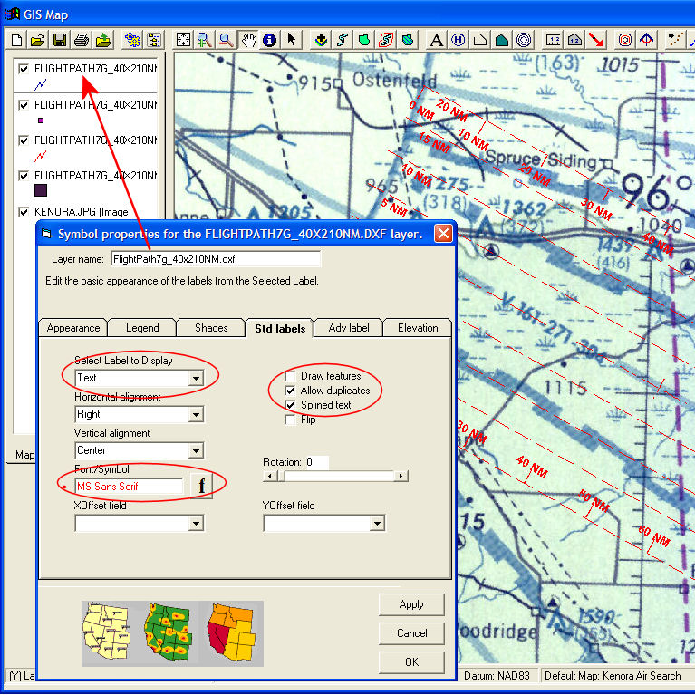
When the CAD template has been added to the GIS display it's appearance can be changed by right-clicking the template map layer and changing it's properties: |
 |
|
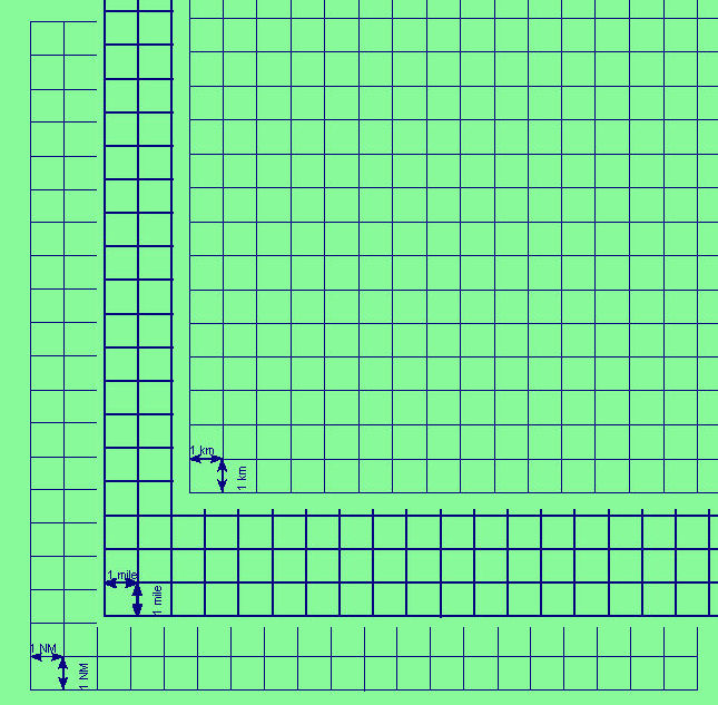
Transparent Overlay Grids  |
|
| 20x20x1NauticalMileGrid 20x20x1mileGrid 20x20x1KmGrid |